Feature overview
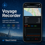
Voyage Recorder is the dedicated Voyage tab in Nauti Control. It turns your phone into a chartplotter-style logbook that records while you sail — using phone GPS together with live boat data from your Nauti Control hardware (heading, speed through water, wind, depth, and more).
Everything is stored on-device. No account required to log a trip.
What you can do
1. One-tap recording on the chart
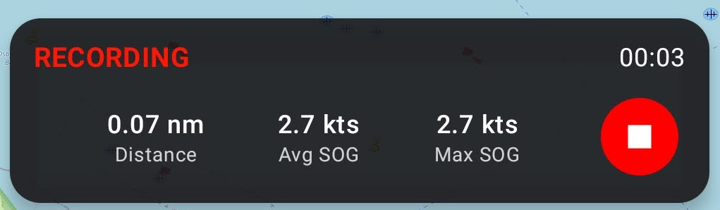
Start recording from the Voyage map with a single control. While recording:
- Status shows RECORDING
- Elapsed time updates live
- Distance, average SOG, and max SOG update as you sail
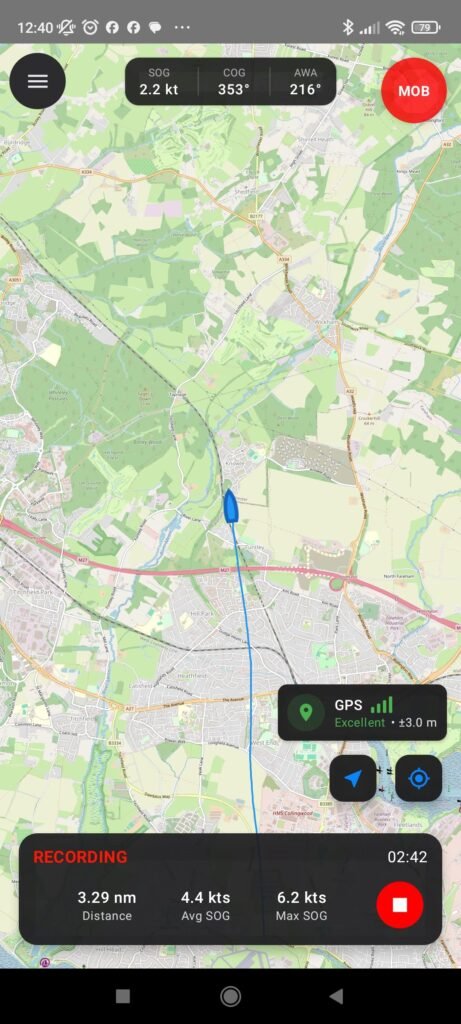
- Your track is drawn on the chart in real time
- The map follows the boat so you stay oriented
When you finish, choose Stop & Save to keep the voyage, or keep going. On Android you can also discard a recording you don’t want to keep.
2. Full instrument log — not just a GPS breadcrumb
Every second while recording, Nauti Control stores a structured snapshot of the voyage, including:
| Data | Source |
|---|---|
| Latitude & longitude | Phone GPS |
| GPS altitude & accuracy | Phone GPS |
| Course over ground (COG) | Phone GPS |
| Speed over ground (SOG) | Phone GPS |
| Heading | Boat instruments (with GPS fallback) |
| Speed through water (STW) | Boat instruments |
| Depth | Boat instruments |
| Apparent wind speed & angle | Boat instruments |
| True wind speed & direction | Boat instruments |
That means your voyage history is useful for performance review — not only “where we went,” but how the boat was sailing.
3. Chart view built for sailing
The Voyage screen uses OpenSeaMap seamark charts with:
- Boat position and heading
- Live voyage track
- Configurable top data strip (three values you choose — e.g. SOG, COG, AWA, AWS, STW, HDG, DPT)
- Follow / centre-on-GPS controls
- GPS quality indicator
Waypoints and Man Overboard tools live on the same map, so logging and safety stay in one place.
4. Waypoints that travel with the voyage
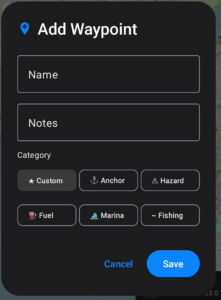
Drop waypoints while underway (or from the Voyage menu). Each waypoint can include:
- Name and notes
- Category: Custom, Anchorage, Hazard, Fuel, Marina, Fishing
- Position and timestamp
- Optional link to the current voyage session
Waypoints appear on the chart and are included when you export to GPX.
5. Voyage history & trip statistics
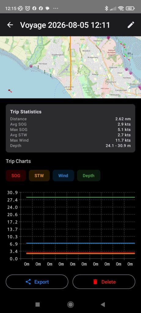
Open Voyages to browse every saved session. Each entry shows duration and point count. Tap a voyage to review:
- Mini-map with the recorded track
- Trip Statistics: Distance, Avg SOG, Max SOG, Avg STW, Max Wind, Depth range
- Rename, export, or delete
Sessions are named automatically (e.g. Voyage 2026-08-05 14:30) and can be renamed anytime.
6. Trip charts
For any saved voyage, open Trip Charts to plot instrument data over time:
- Speed over ground (SOG)
- Speed through water (STW)
- Wind
- Depth
Toggle series on or off to focus on what you care about. Depth respects your app unit preference (metric or imperial).
7. Export to GPX or NMEA
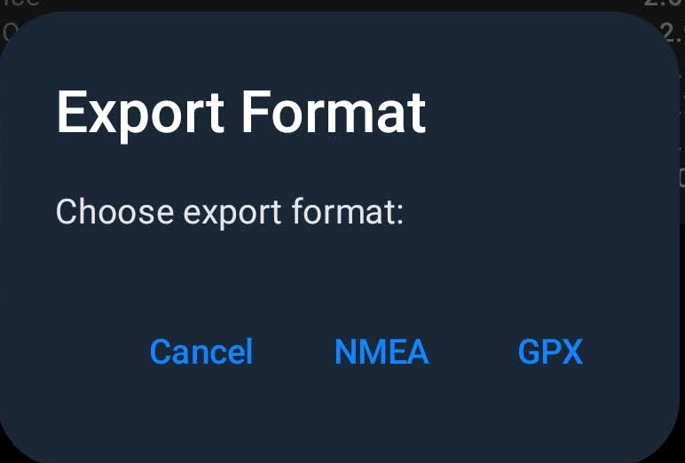
Share a voyage with other tools via the system share sheet:
| Format | Best for |
|---|---|
| GPX 1.1 | Charts, planning software, archives — includes track, waypoints, and Nauti instrument extensions |
| NMEA 0183 | Marine tools that ingest sentence streams — includes RMC, GGA, HDG, MWV, DBT, VHW derived from your log |
Export works offline when sharing to another app or file on the device.
8. On-device & offline-friendly
- Voyages are stored in a local database on the phone
- Recording, review, charts, rename, and delete work without a cloud account
- Instrument values come from your connected Nauti Control data; position comes from phone GPS
- Chart tiles need a network connection unless already cached by the map
Your sailing log stays on your device.
9. Safety tools on the same map
While you’re on the Voyage chart you can:
- Mark MOB with bearing, distance, and elapsed time
- Send / clear a BLE MOB alert via Nauti Control hardware (where supported)
- Keep recording while you deal with the situation
Voyage logging doesn’t replace seamanship — it keeps the chart and tools in reach.
How a typical voyage works
- Open the Voyage tab and allow location access when prompted.
- Connect to your Nauti Control hardware so instrument data is live (optional for a GPS-only track; recommended for a full log).
- Tap Record — the map follows the boat and the track begins.
- Sail. Optionally add waypoints for anchors, hazards, or marinas.
- Tap Stop, then Stop & Save.
- Later, open Voyages → pick the trip → review track, stats, and charts → export if needed.
At a glance
| Capability | Detail |
|---|---|
| Sample rate | 1 Hz (once per second) while recording |
| Track | Live polyline on OpenSeaMap |
| Live stats | Distance, Avg SOG, Max SOG, elapsed time |
| Post-trip stats | Distance, duration, SOG, STW, wind, depth |
| Charts | SOG, STW, Wind, Depth vs time |
| Waypoints | Named, noted, categorised; included in GPX |
| Export | GPX and NMEA via share sheet |
| Storage | On-device (no cloud required) |
| Platforms | iOS and Android |
Leave a Reply
You must be logged in to post a comment.