The Navionics Boating app can use your boat’s own GPS position, speed and depth instead of your phone’s. It reads them over Wi-Fi from an NMEA 0183 device, and the Nauti-Control controller (N2K Wireless or ST Wireless) works as one. Here’s how to connect it.

What You Need
- A Nauti-Control N2K Wireless or ST Wireless controller on your boat’s network.
- The Navionics Boating app on your phone or tablet, with charts downloaded for your area.
1. Join the Controller’s Wi-Fi
Connect your phone or tablet to the controller’s Wi-Fi network. Android may say “No internet access”; that’s expected. Download your Navionics maps (Menu, Download Maps) before you leave, so they work offline.
2. Add the Controller in Navionics
- Open Menu and choose Paired Devices.
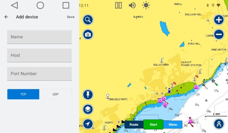
- Under “Not working? Try manually adding your NMEA 0183 Wi-Fi device”, tap Add Device.
- Name: anything, for example Nauti-Control.
- Host:
192.168.1.1 - Port Number:
8091 - Keep TCP selected and tap Save.
3. Check It’s Connected
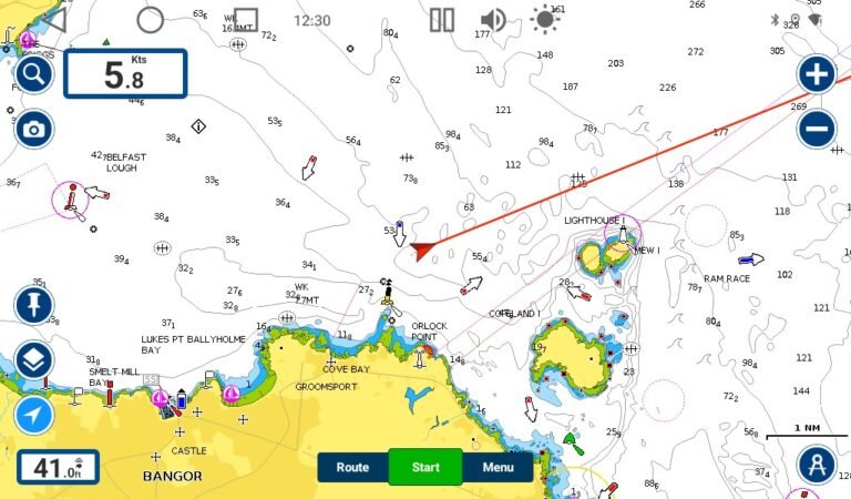
Paired Devices now shows the controller as Connected, with Sonar: Receiving data (depth) and External GPS: Receiving data.
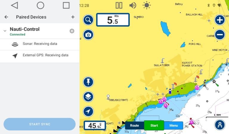
Close the menu and tap the locate button. Your boat shows at your own GPS position, with speed over ground and depth on the chart.
Good to Know
- On our test bench Navionics used position, speed, course and depth. It has no wind or heading display, so for those, and for your autopilot, run the Nauti-Control app alongside it. On an Android tablet or the M22 display you can use split screen.
- If the controller is joined to your boat’s own Wi-Fi router, use the address your router gave it instead of 192.168.1.1. The port is still 8091.
Questions? Leave a comment on the video or email admin@nauti-control.com.
Navionics is a Garmin brand and is not connected with Nauti-Control. Nauti-Control is a supplementary aid, not a replacement for your chartplotter or a proper lookout.
Leave a Reply
You must be logged in to post a comment.