OpenCPN is a free chartplotter, and on an Android phone or tablet it can show your boat’s wind, depth, heading and speed from the Nauti-Control controller (N2K Wireless or ST Wireless). Here’s how to connect it and set up the dashboard.

What You Need
- A Nauti-Control N2K Wireless or ST Wireless controller on your boat’s network.
- OpenCPN for Android, with charts installed for your area. OpenCPN’s built-in base map is only a rough world map.
1. Join the Controller’s Wi-Fi
Connect your phone or tablet to the controller’s Wi-Fi network. Android may say “No internet access”; that’s expected.
2. Add the Connection
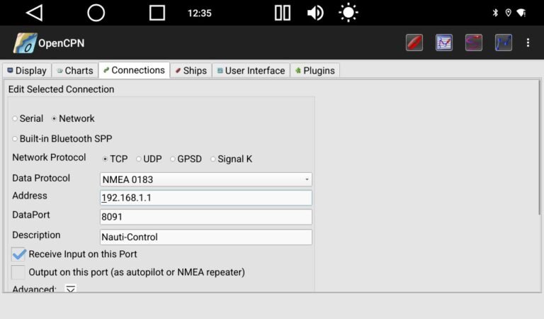
- In OpenCPN, tap the settings (gear) button and open the Connections tab.
- Tap Add new connection.
- Choose Network, then TCP, with Data Protocol NMEA 0183.
- Address:
192.168.1.1 - DataPort:
8091 - Leave Receive Input on this Port ticked and Output on this port unticked.
- Press OK, then Apply.
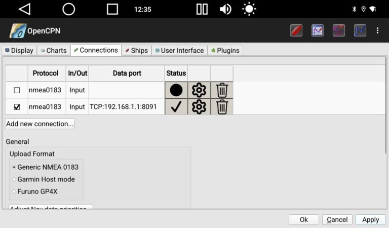
A tick in the Status column means data is arriving. If you also have an input for the tablet’s own GPS, untick it, so OpenCPN uses your boat’s GPS instead.
3. Add Your Instruments to the Dashboard
- Tap the dashboard button on the toolbar.
- Long-press the dashboard and choose Preferences.
- Tap Add and pick the instruments you want, for example App & True Wind Angle, True HDG and Depth.
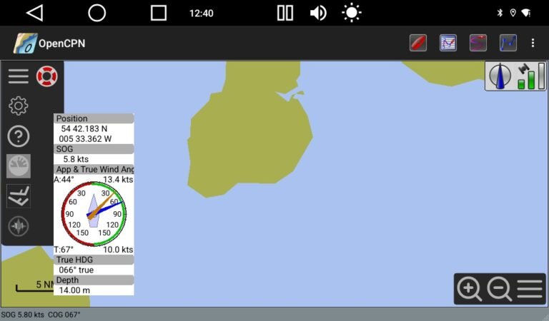
Good to Know
- OpenCPN works out true wind from the apparent wind and your speed.
- If the controller is joined to your boat’s own Wi-Fi router, use the address your router gave it instead of 192.168.1.1. The port is still 8091.
Questions? Leave a comment on the video or email admin@nauti-control.com.
OpenCPN is free, open-source software by the OpenCPN project, which is not connected with Nauti-Control. Nauti-Control is a supplementary aid, not a replacement for your chartplotter or a proper lookout.
Leave a Reply
You must be logged in to post a comment.